|
27 March 2010 - Warkworth Beach and the River Coquet Walk.
We visited Warkworth Beach today for a walk to Amble North Breakwater and the River Coquet. It was a fine day compared to our last beach walk at Blyth, although quite windy and the sand was being whipped up near the breakwater.
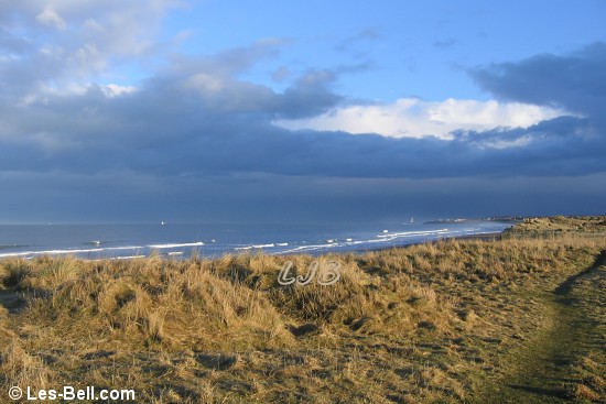
The first two photos below are views to Coquet Island seen from the dunes above Warkworth Beach followed by a view along the beach from the breakwater.
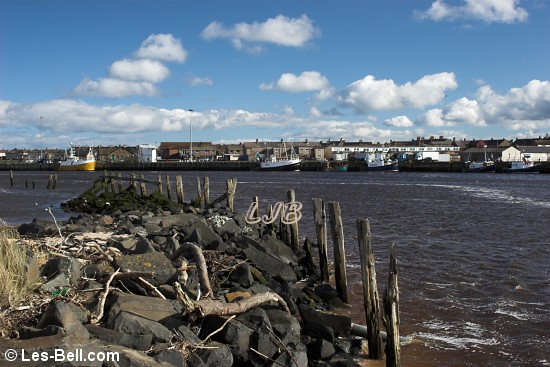
The fourth photo is a view along the old quay wall on the north side of the River Coquet, next to the old mooring jetties, the remains of which are seen in the next photo. The last photo is a view across the River Coquet to Amble Lifeboat Station and the boat yard behind it where a lifeboat was out of the water.
|
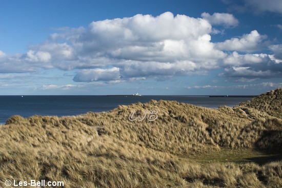
Coquet Island seen from the dunes at Warkworth Beach, Northumberland.
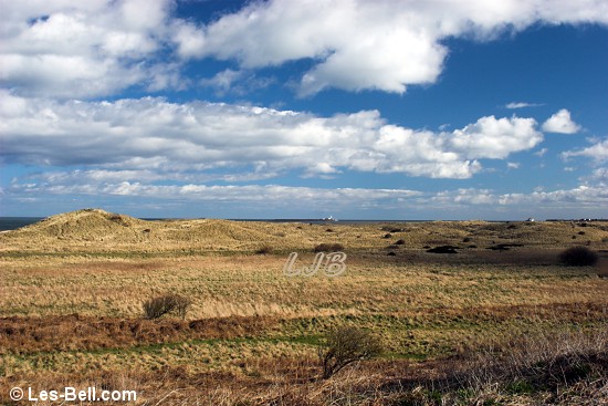
Coquet Island seen from the dunes at Warkworth Beach, Northumberland.
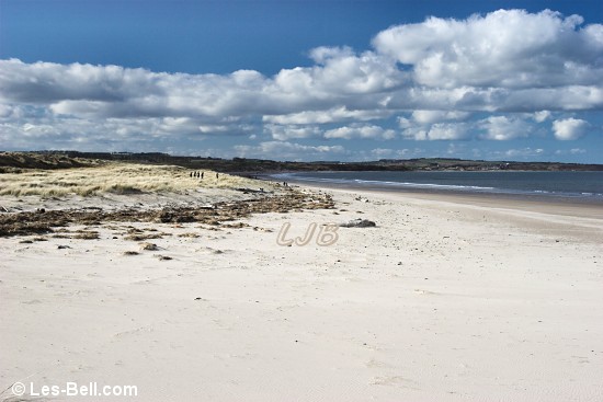
Warkworrth Beach, looking north from Amble North Breakwater.
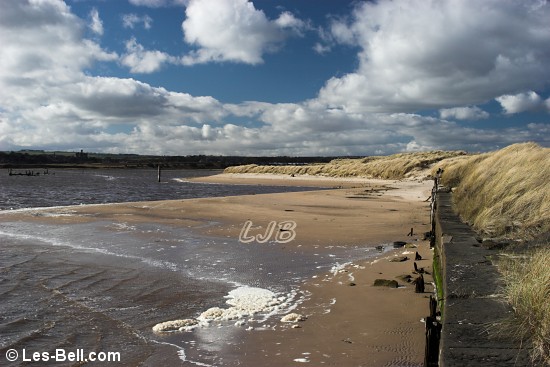
Old quay wall on the north side of the River Coquet.
View along the old mooring jetties on the north side of the River Coquet.
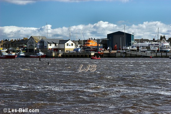
View across the River Coquet to Amble.
|
14 March 2010 - Blyth South Beach Walk.
Today we visited Blyth South Beach for a walk along the beach and dunes towards Seaton Sluice. Not long after we set off a very heavy rain shower arrived from the north, darkening the sky and drenching many of the people out walking. Afterwards, the sun appeared to create a lovely late afternoon lighting effect across the dunes and beach.
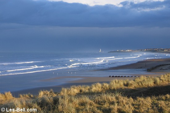
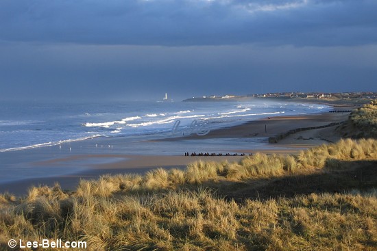
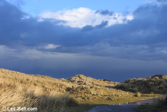
The first three photos below are views along the beach towards Seaton Sluice and St. Mary's Island, after the rain had cleared. The next two photos are views along the path through the dunes, also after the rain.
The last photo is a view looking north along the beach when the skies darkened just before the rain arrived.
|
Blyth South Beach, Northumberland.
Blyth South Beach, Northumberland.
Blyth South Beach, Northumberland.
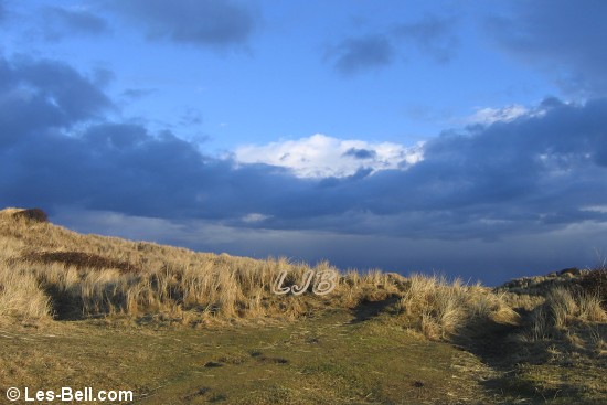
Path through the dunes at Blyth South Beach, Northumberland.
Path through the dunes at Blyth South Beach, Northumberland.
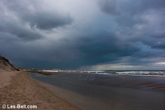
Before the storm at Blyth South Beach, Northumberland.
|
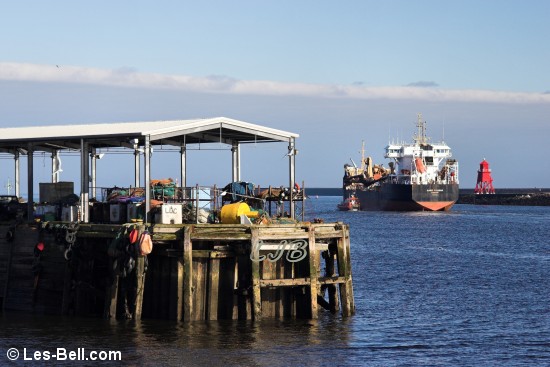
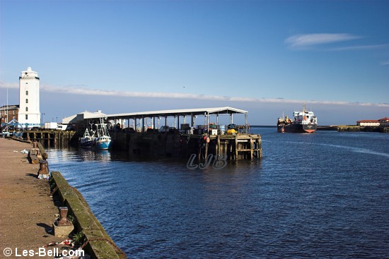
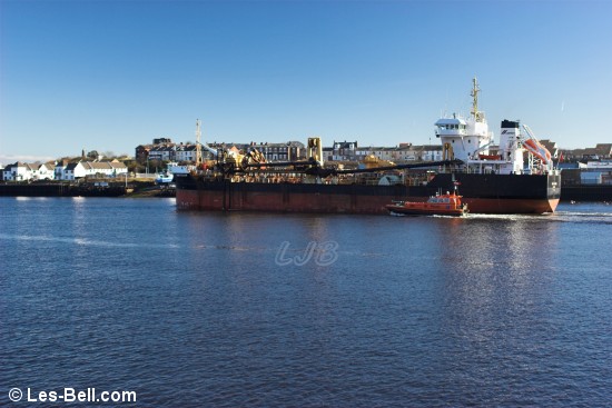
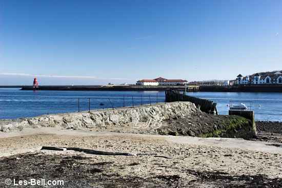
08 March 2010 - North Shields Fish Quay.
After we visited Tynemouth today we stopped at North Shields Fish Quay to take a few photos. A dredger, the Sand Fulmar, was leaving the River Tyne accompanied by one of the Tyne Pilot Boats, as seen in the first three photos below.
The fourth photo is a view across the River Tyne to Herd Groyne at South Shields and the last photo is a view to the Collingwood Monument at Tynemouth.
|
Dredger passing North Shields Fish Quay.
Dredger passing North Shields Fish Quay.
Dredger passing North Shields Fish Quay.
View to South SHields and Herd Groyne.
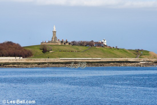
View to the Collingwood Monument at Tynemouth.
|
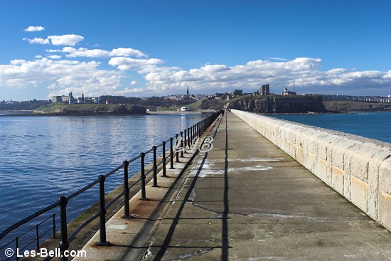
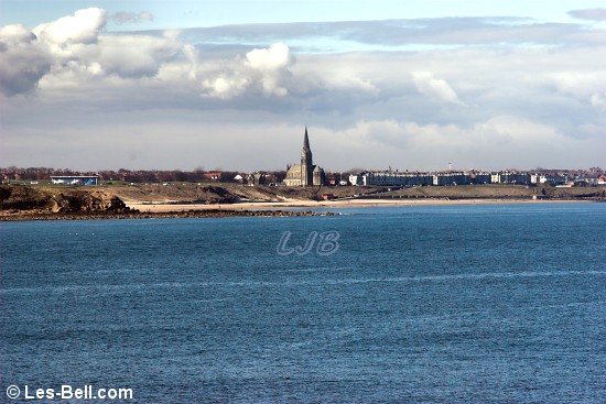
08 March 2010 - Tynemouth Pier.
Today we visited Tynemouth for a walk along the pier before visiting the fish quay at North Shields. It was another day of sunshine and clear blue skies with hardly a breath of wind and was remarkably mild on the pier.
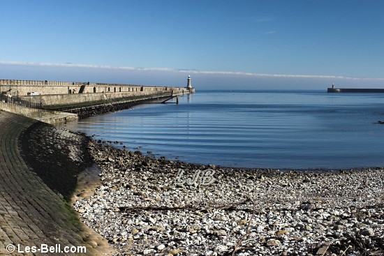
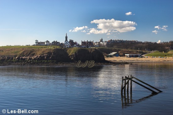
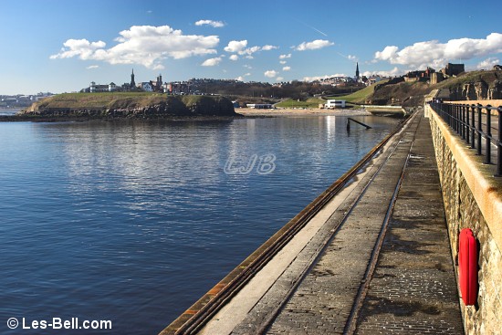
The first photo below is a view along the pier from the shore beside the yacht club. The next two photos are views looking back to the headland from the pier followed by a view of the lighthouse.
The fifth photo is a view back along the pier from the lighthouse, followed by a view to Longsands Beach. The last photo is a view of ships anchored near the pier waiting to enter the River Tyne.
|
Tynemouth Pier.
View to the headland at Tynemouth from Tynemouth Pier.
View to the headland at Tynemouth from Tynemouth Pier.
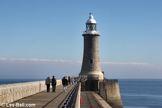
Tynemouth Lighthouse.
View along Tynemouth Pier from the lighthouse.
View to Longsands Beach from Tynemouth Pier.
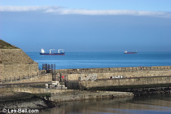
Ships anchord near the mouth of the River Tyne.
|
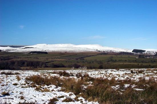
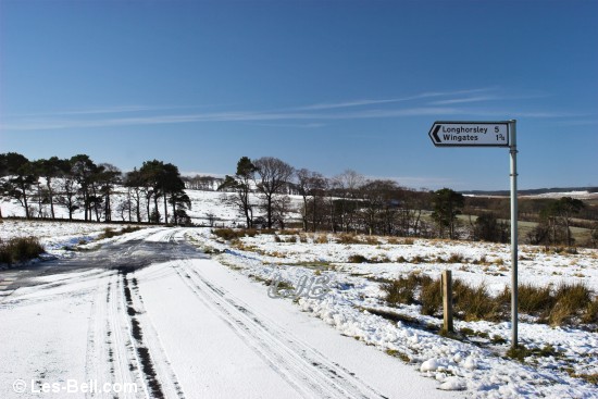
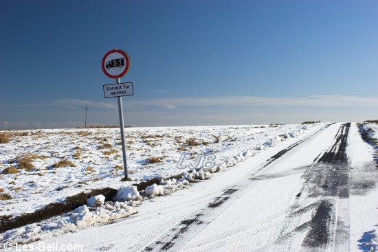
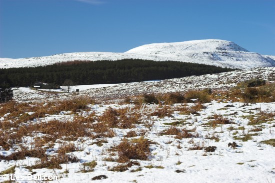
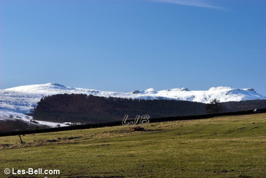
01 March 2010 - Simonside Views, Northumberland.
On the way to Rothbury today we turned off the snowbound and very icy road near Forestburn Gate and along the narrow road to Embleton Terrace. We stopped at the junction of the road to Longhorsley to take some photos of the surrounding countryside.
The first photo below is a view across the Forest Burn valley to the Simonside hills, taken from the location of the next two photos of the ice and snow covered road.
The fourth photo is a view towards Rothbury and beyond to the hills at Debdon. The last two photos are views of the Simonside Hills gleaming in the winter sunshine, seen from the road into Rothbury.
|
Simonside Hills.
Very icy road.
Snowbound road to Wingates.
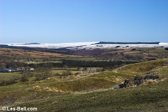
View to Rothbury and Debdon.
Simonside Hills seen from the road to Rothbury.
Simonside Hills seen from the road to Rothbury.
|
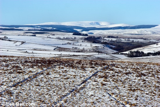
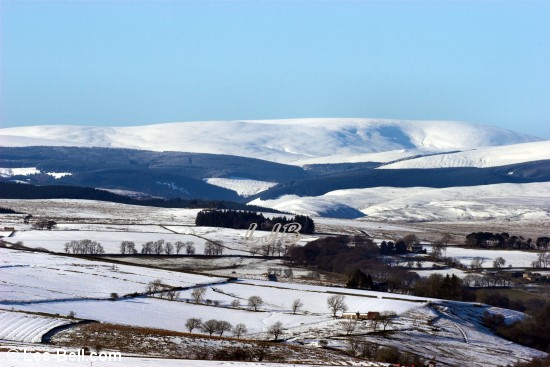
01 March 2010 - Battle Hill and Winters Gibbet, near Elsdon, Northumberland.
We decided to visit Elsdon, Otterburn and Simonside today to take photos for our Northumberland Website. The weather turned out to be superb and snow from a couple of days earlier was still lying thickly on the hills. The whole landscape was gleaming under the clear blue sky.
The first two photos below are views of the Cheviot seen from Battle Hill viewpoint near Elsdon. The third photo, taken from the same place shows an old ruined cottage in a bleak setting on the edge of Harwood Forest.
The fourth photo is a view beside the Northumberland National Park entrance sign near Winters Gibbet, which is seen in the next photo. The last photo is a view from Winters Gibbet looking south towards Newcastle which can just be seen in the far distance.
|
The Cheviot seen from Battle Hill near Elsdon.
The Cheviot seen from Battle Hill near Elsdon.
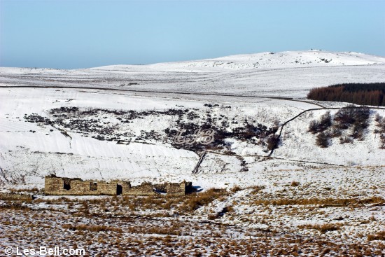
Ruined Cottage near Harwood Forest.
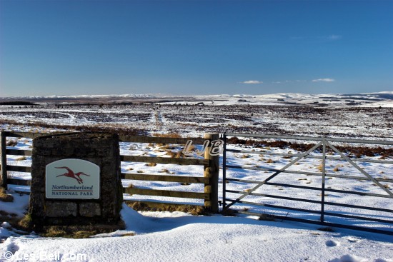
Northumberland National Park entry sign.
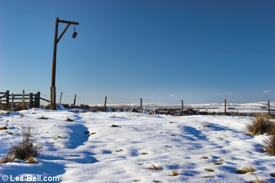
Winters Gibbet.
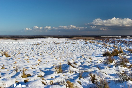
View from Winters Gibbet.
|
|
Photographers Diary Pages
|
|
|
© Copyright - All photos on this website are
subject to copyright and may not be reproduced on any website or
in print without prior permission. To use any photo please use the
enquiry form at les-bell.com
|