|
29 April 2009 - Blyth South Beach Walk, Northumberland.
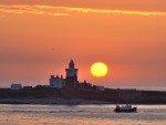
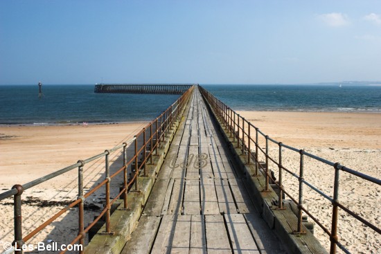
Today we walked along the South Beach at Blyth to the harbour. Despite being bright and sunny it was very cold due to the light wind blowing off the sea. The beach was virtually empty apart from a few other walkers, mainly dog owners. It was a good day for sailing with the sea not too rough and one yacht was making it's way out to sea as we arrived at the west pier, as seen in the first photo below.
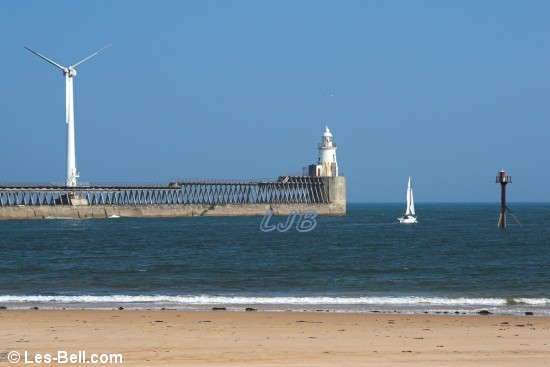
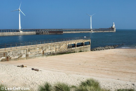
The second photo below is a view of the east pier taken from the top of the harbour wall, followed by a view along the west pier.
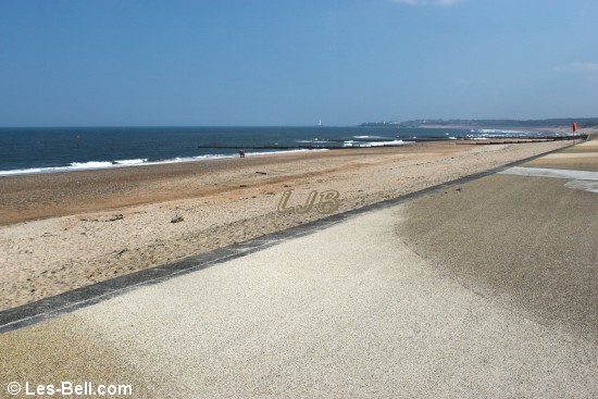
Further along the beach at the promenade resurfacing work seems to be complete and the last two photos are views looking in each direction near the new beach huts that are being built there.
|
Blyth South Beach
Blyth Piers.
Blyth West Pier
Blyth South Beach.
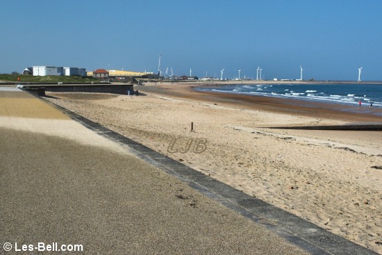
Blyth Promenade and South Beach.
|
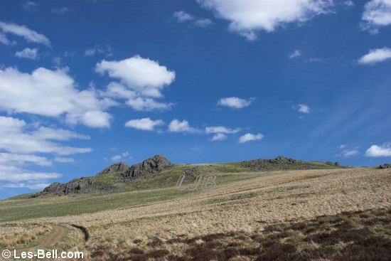
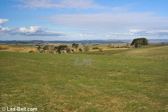
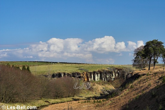
22 April 2009 - Harthope Valley Walk, Cheviot Hills, Northumberland.
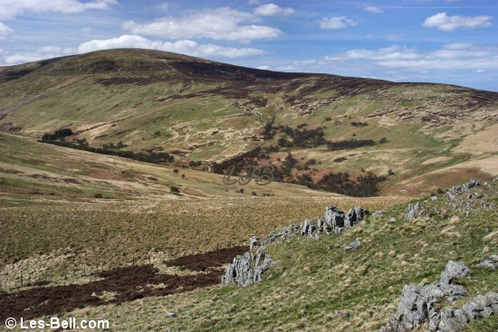
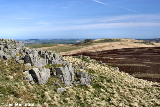
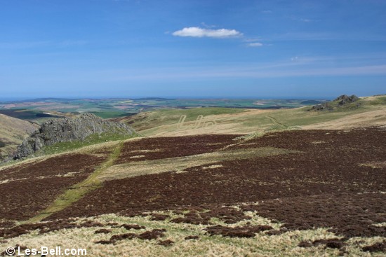
Today we went walking in the Cheviot Hills in Northumberland. We set off from the parking area near Langleeford in the Harthope Valley and walked straight up the steep south side of the valley to Housey Crags, passing a sunbathing Adder on the way. After stopping to take photos from the top of the crags we moved on to the top of Long Crags where the views are fantastic on a clear day such as this.
The first photo below is a view of the Cheviot seen from the Harthope Burn, followed by a view along the valley from the top of Housey Crags. The third photo is a view of Housey Crags from the south. The fourth and fifth photos are views of the Cheviot seen from Long Crags, followed by three views taken from the top of Long Crags and a view from the bottom. The last photo is a view of Langlee Crags which we intend to visit in the near future.
|
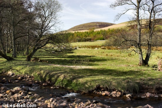
Harthope Valley, Cheviot Hills, Northumberland.
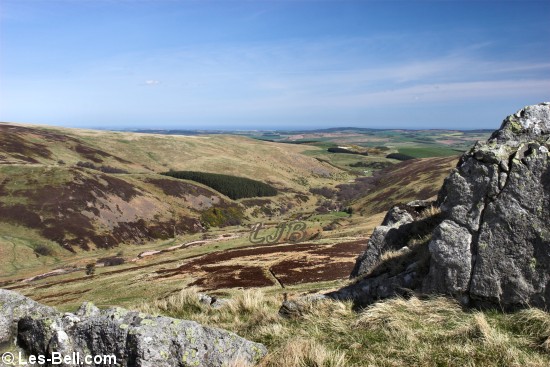
Harthope Valley seen from Housey Crags, Cheviot Hills, Northumberland.
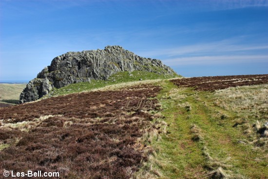
Housey Crags, Cheviot Hills, Northumberland.
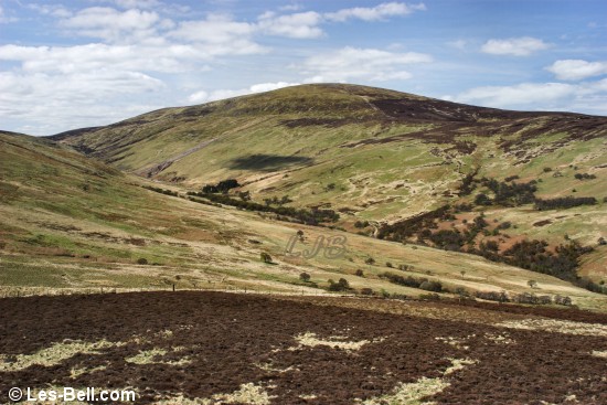
The Cheviot, seen across the Harthope Valley, from Long Crags.
The Cheviot, seen across the Harthope Valley, from Long Crags.
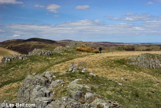
On top of Long Crags, Cheviot Hills, Northumberland.
View from Long Crags, Cheviot Hills, Northumberland.
Housey Crags and Langlee Crags seen from Long Crags.
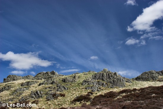
Long Crags, Cheviot Hills, Northumberland.
Langlee Crags, Cheviot Hills, Northumberland.
|
11 April 2009 - Amble Harbour Walk, Northumberland Coast.
This afternoon we visited Amble for a walk around the harbour and pier. The entrance to the pier is still barred off with work on the quayside subsidence seemingly abandoned for the moment. So access is still along the promenade and breakwater. There were quite a lot of people fishing on the pier but we always wonder if anyone ever catches very much.
The first photo below is of fishing boats moored at the quayside, followed by two photos looking over the small beach to the pier and promenade. The last photo is a view of anglers at the end of the pier.
|
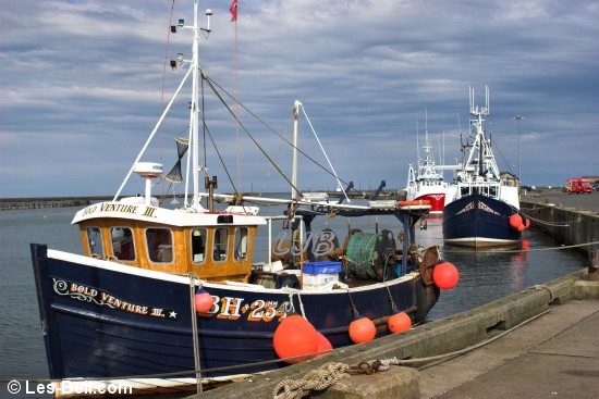
Fishing boats at Amble Quayside.
Little Shore, Amble.
Little Shore, Amble.
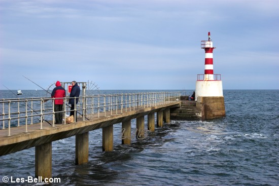
Fishing on Amble Pier.
|
07 April 2009 - Bolam Lake Walk, Northumberland.
This afternoon we visited Bolam Country Park for a walk around the lake, to take photos for our Northumberland website. It was another day of white fluffy clouds but a few big black ones were carrying heavy rain showers. In between the showers the sun shone brightly allowing some photo opportunities.
The swans always move in quickly at the first sign of food and while we had none other people did, resulting in a large gathering as seen below. There are also some Canada Geese that seem to reside at the lake and a pair of them are seen in the third photo happily pottering about the lakeside. On the way back we stopped at nearby St. Andrew's Church to take some photos, one of which is the bottom photo below.
|
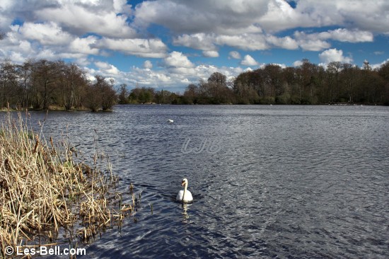
Swans at Bolam Lake and Country Park, Northumberland.
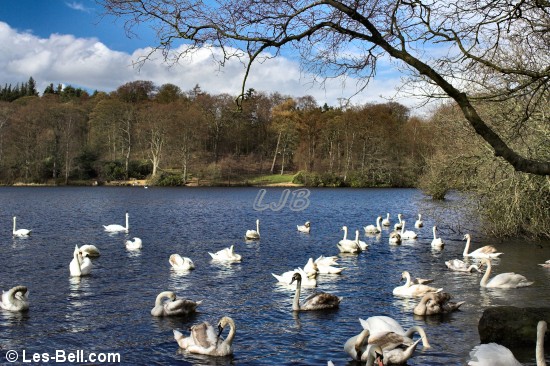
Swans at Bolam Lake and Country Park, Northumberland.
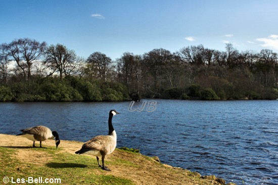
Geese at Bolam Lake and Country Park, Northumberland.
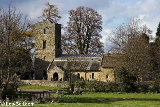
St. Andrew's Church, Bolam, Northumberland.
|
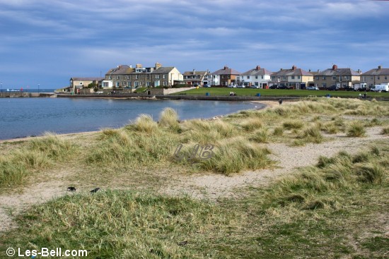
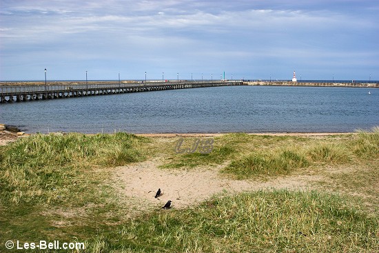
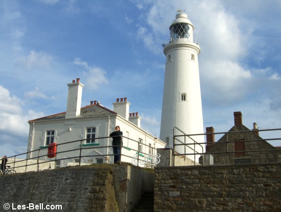
05 April 2009 - St. Mary's Island Walk, Tyne and Wear.
This afternoon we visited Seaton Sluice at the far south end of the Northumberland Coast and walked along the cliffs to St. Mary's Island. The tide was out so we crossed the causeway to the lighthouse. As it was a fine Sunday afternoon there were a lot of other visitors to the tiny island which used to be part of Northumberland.
Below are two views of the Island from the mainland and two views of the lighthouse from the rocks.
|
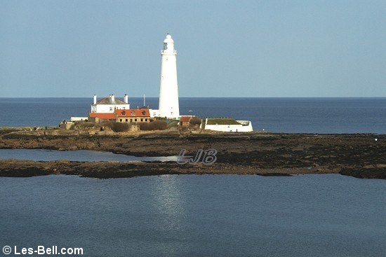
St. Mary's Island and Lighhouse.
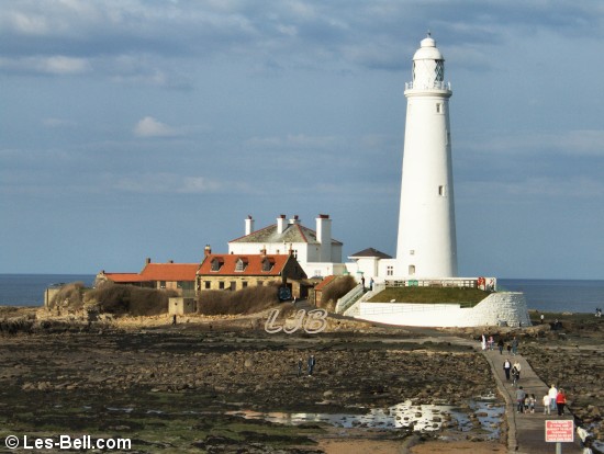
St. Mary's Island and Lighhouse.
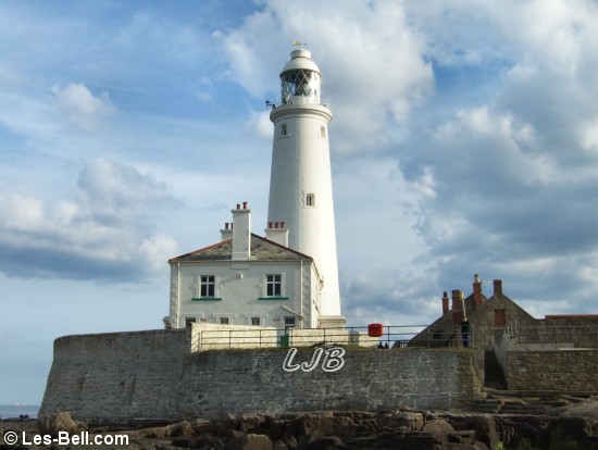
St. Mary's Island and Lighhouse.
St. Mary's Island and Lighhouse.
|
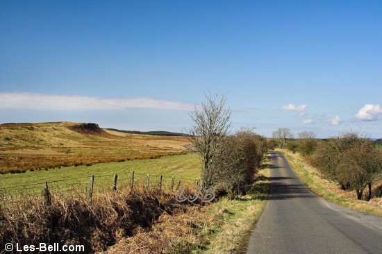
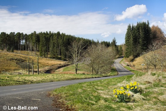
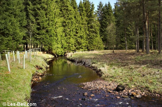
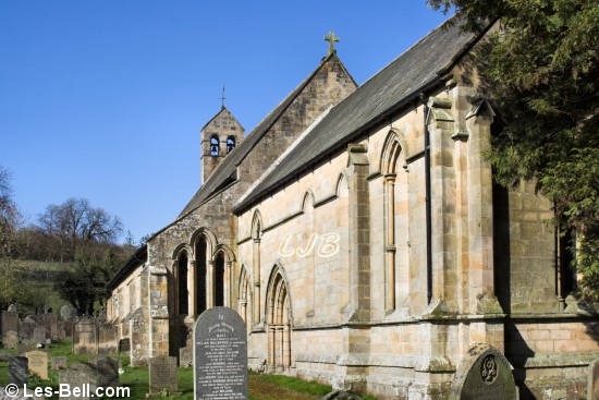
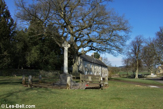
01 April 2009 - Stonehaugh Walk and Simonburn Church, Northumberland.
This morning we visited Stonehaugh in Kielder Forest for a walk along the waymarked trails and to take photos for our Northumberland website. On the way we stopped at nearby Simonburn to take some photos of the church and village.
The first two photos below are views of Broadpool Common and Ravensheugh Crags taken from the road to Stonehaugh. The next three photos are views of Warks Burn passing through the deep gorge at Stonehaugh, the nearby forest walks car park and the burn in Kielder Forest. The last two photos are views of St. Mungo's Church and Simonburn village.
|
Broadpool Common and Ravenseugh Crags, Northumberland.
Broadpool Common
Warks Burn, Stonehaugh, Kielder Forest, Northumberland.
Warks Burn, Stonehaugh, Kielder Forest.
Warks Burn, Stonehaugh, Kielder Forest.
St Mungo's Church, Simonburn.
St Mungo's Church, Simonburn.
|
|
Photographers Diary Pages
|
|
|
© Copyright - All photos on this website are
subject to copyright and may not be reproduced on any website or
in print without prior permission. To use any photo please use the
enquiry form at les-bell.com
|